Architecture & Planning
// Buildings & Evolution of the Site
A Typical Castello in Rural Umbria
The fortified villages in the papal countryside were generally not grand castles like you see in fairy tales. They usually started out as farming villages and were later fortified over time, out of necessity and using basic construction techniques.
Fortified villages were typically set on a hilltop, with the main road going around the base of the hill, forming a sort of pocket for the protected center of the village. Protection was afforded by abutting the stone (or wooden) buildings around the perimeter of this pocket, to form a wall. Each point of ingress would be protected by a gate.
These villages had one or two main streets. For smaller villages, one street was enough. The street would either run through the middle of the village, or the village would be built along one side, depending on the geography of the site. In a hilltop context, the street would typically run along the edge of the hilltop, with a horseshoe ring of buildings on one side, and a more linear configuration on the opposite side of the street. Within the horseshoe would be the village center.
In the center, a church and a watchtower would be built. The other structures would be houses, agricultural buildings or stables, or some combination thereof. As the village grew, new structures would be built around the perimeter of the fortified core, depending on the features of the site.
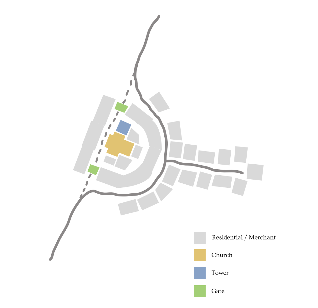
Theoretical mapping illustrating the layout of perimeter residential defenses wrapping tightly around a centralized watchtower and church core.
Note the preserved, circular perimeter structure curtain configuration still evident in the valley landscape today.
A Living Reference
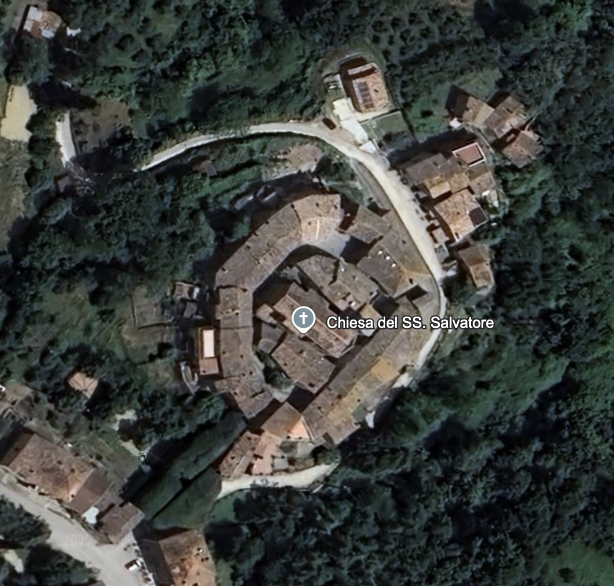
You can still experience what the a rural castello in Umbria looked and felt like. The charming village of Doglio is a wonderful example and retains its original centro storico and medieval stone structures, including a small gate house adorned with the crest of Todi, which was a powerful city-state that governed the region.
Alongside Doglio and another castello named Quadro (now lost), Roscialesco formed a defensive line that helped protect Todi from threats from the Northwest.
"To learn more about Doglio and its history, you can read: Il Castello di Doglio: Archeologia, famiglie, chiese e territorio by Filippo Orsini, 2019."
The Complex at Roscialesco
During its peak in the late 13th century, about 100 people lived in the Castello di Roscialesco. During this period it would have been a busy village, and while a bit smaller, it would have looked a lot like the centro in Doglio, and was probably configured in the same horseshoe shape, although the perimeter buildings are lost.
Only a few of the original structures remain at Roscialesco. The tower still stands, and it commands an impressive view over the valley below. Originally a watchtower, it was modified and converted to residential use over the years.
There is an ancient building attached to the tower on the Southwestern side which was likely mixed use (stable and residential). Various other stone structures and ruins can be found on the site as well, including a portion of crenellated wall, and a small stone building that was recently rebuilt but remains unfinished. Portions of the old stone walls can still be found along the Northeastern edge of the hilltop, along with the original road.
Outside the original centro, just down the hill, a large farmhouse remains, in a relatively good state of preservation.
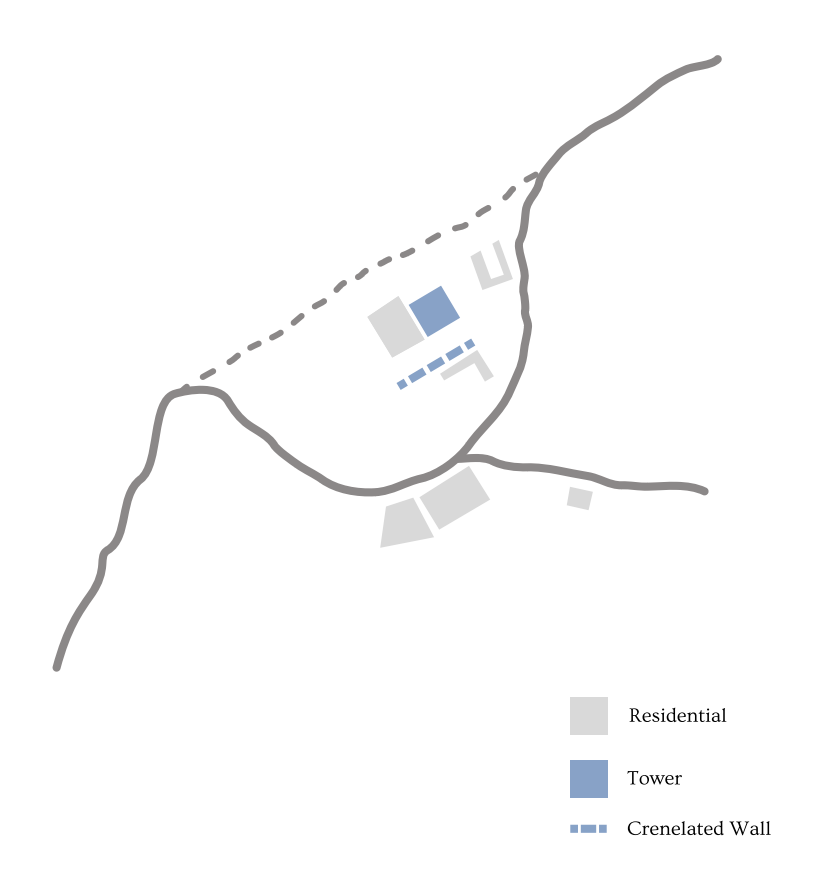
Plan indicating the surviving structures, ruins, and the line of the crenellated wall fragment.
Roscialesco in Maps
Roscialesco appears in numerous maps of Central Italy, from the Renaissance through 19th-century land registries.
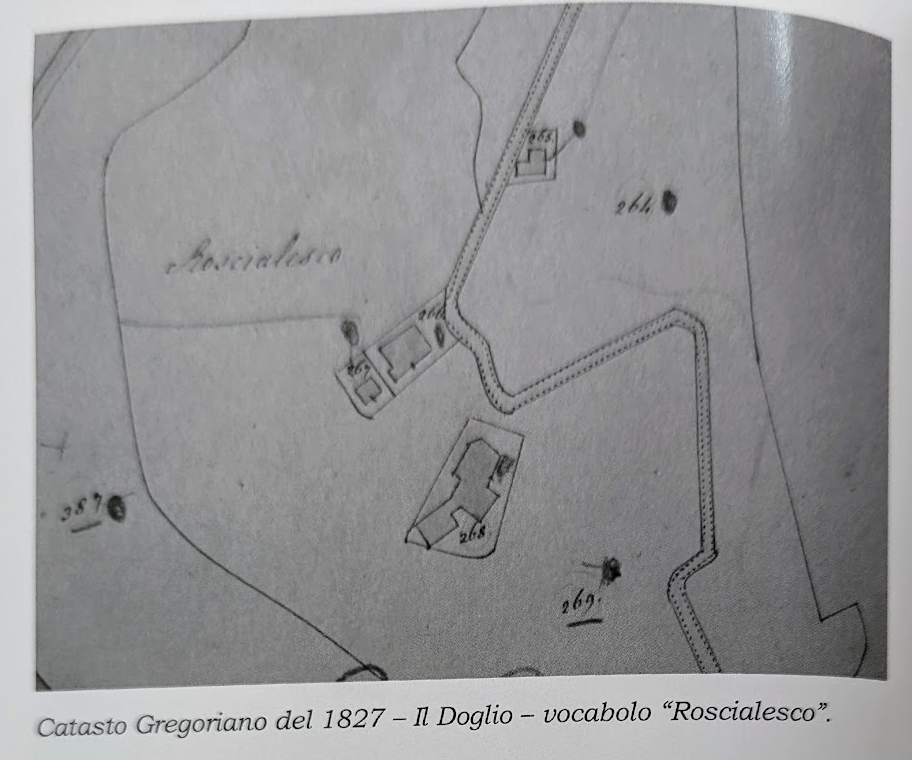
The 1827 Cadastral Survey
In his research on Doglio, Dr. Orsini discovered a Cadastral map of Roscialesco from 1827. This map is instructive in a few key areas:
It shows that the site at Roscialesco was largely already a ruin by 1827. Interestingly enough, the buildings shown in this map are essentially the same ones that exist today.
The property was portioned into several lots, 266 being the Tower, 267 being a small stone building which today has been rebuilt in situ from the existing stones, and 268 which is the farmhouse. So, the village was inhabited by just 3 families who probably made their living farming the hillside.
It shows the main road coming up from the south and then cutting westward towards the complex. This road is no longer in use and was replaced by another which instead chicaynes down the valley from a departure towards the West.
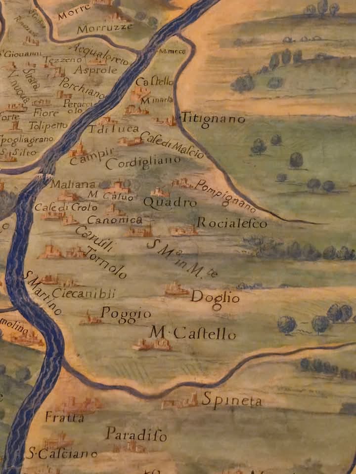
Map of Umbria in the Vatican Gallery of Maps
Preserved inside the Vatican Museum's Gallery of Maps, this painted chorographical masterwork was executed between 1580 and 1583 under the scientific guidance of famed cosmographer Ignazio Danti.
The site is clearly labeled as ***Rocialesco***, positioned alongside its neighboring strongholds of Doglio, Canonica, and the lost castle of Quadro. While drawn with stylistic flair rather than exact engineering coordinates, the illustration serves as an invaluable primary document, showing that the settlement was prominent enough to be mapped by the Papal States. Coincidentally, the drawing accurately depicts the layout of the three stone structures still standing on the ridge today.